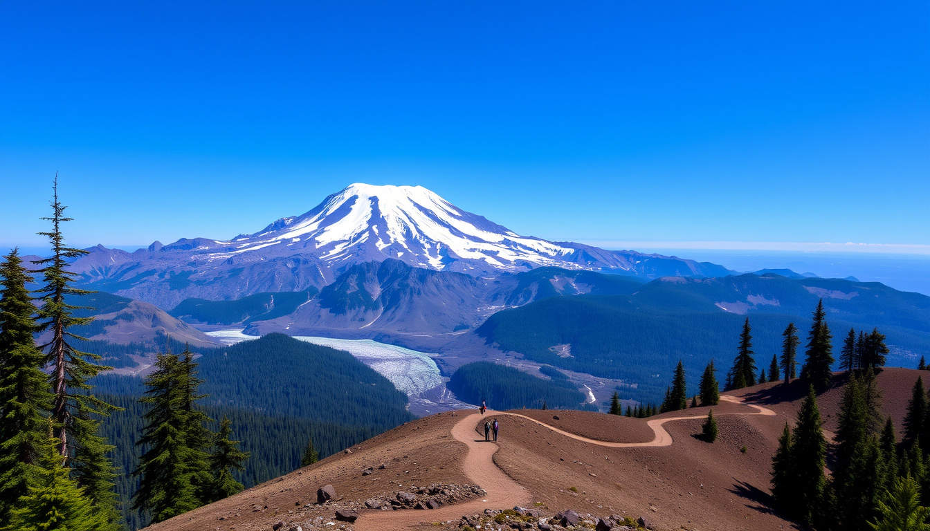
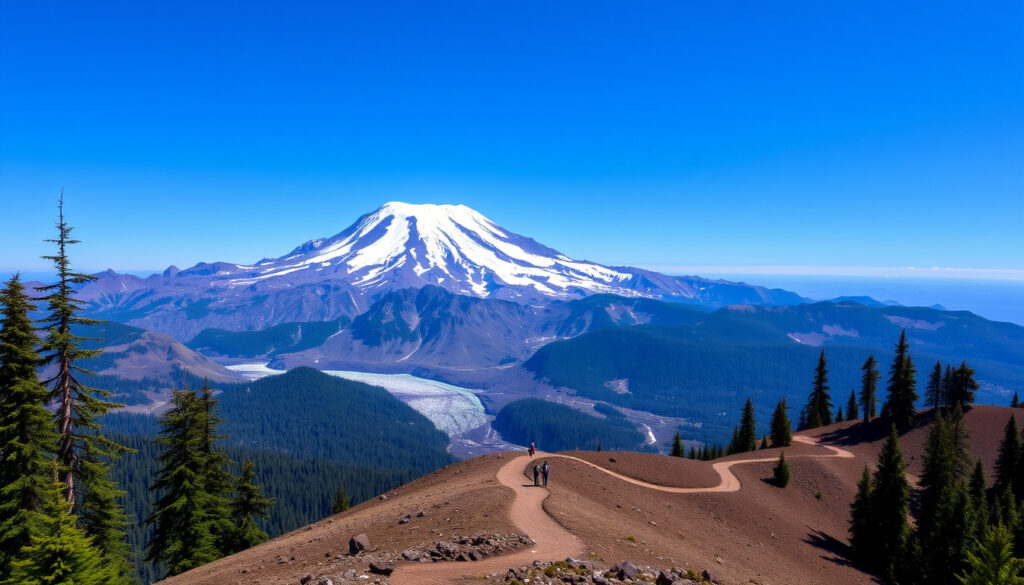
There’s a reason Mount Rainier draws millions of visitors each year while also keeping volcanologists up at night: few places on Earth balance breathtaking alpine beauty with such serious, simmering danger — an active stratovolcano towering over Seattle and Tacoma, yet laced with trails that lead into old-growth forests and wildflower meadows. By the time you finish this guide, you’ll understand exactly why Rainier is called a Decade Volcano, what climbing it really takes, and whether you — or your town — could be in harm’s way when it wakes up.
Height: 14,411 ft (4,392 m) ·
Type: Active Stratovolcano ·
Last Eruption: ~1894 ·
Recorded Fatalities: Over 500 ·
Status: Decade Volcano
Quick snapshot
- Active stratovolcano with last eruption ~1894 (National Park Service)
- 500+ recorded climbing deaths (American Alpine Club)
- Most glaciated peak in the contiguous US (USGS)
- Designated a Decade Volcano in the 1990s (Wikipedia)
- Exact timing of the next eruption is unknown (USGS)
- Precise number of bodies remaining on the mountain is an estimate (American Alpine Club)
- Full extent of damage from a future large eruption depends on multiple variables (Wikipedia)
- ~5,600 years ago: Osceola Mudflow reshaped the landscape (USGS)
- ~1894: Last confirmed eruption (National Park Service)
- 1990s: Designated a Decade Volcano (Wikipedia)
- Present: Continuous monitoring by USGS (USGS)
- Lahar detection drills and evacuation plans continue (USGS) (Recreation.gov)
- Climbing season requires permits via Recreation.gov
- Scientists model eruption scenarios to improve warnings (USGS) (Recreation.gov)
The table below summarizes the key stats that define Mount Rainier.
| Attribute | Detail |
|---|---|
| Elevation | 14,411 ft (4,392 m) |
| Volcano Type | Active Stratovolcano |
| Location | Pierce County, Washington, USA |
| National Park Established | March 2, 1899 |
| First Ascent | 1870 by Hazard Stevens and P. B. Van Trump |
| Monitoring Organization | USGS Cascades Volcano Observatory |
| Last Major Eruption | ~1894 |
| Recorded Climbing Deaths | Over 500 (American Alpine Club) |
| Glacier Count | 25+ major glaciers |
| Lahar Risk Population | ~80,000 people (Wikipedia) |
Mount Rainier draws over two million visitors annually to its wildflower meadows and glaciers, yet those same glaciers are the reason it ranks among the deadliest mountains in the United States — the USGS (volcano hazards division) warns that lahars form the greatest threat to downstream communities.
Why is Mount Rainier so famous?
What is the height of Mount Rainier?
- Mount Rainier stands at 14,411 feet (4,392 meters), making it the highest mountain in Washington and the most topographically prominent peak in the contiguous United States (National Park Service).
- Its elevation exceeds that of K2’s base camp — a sobering reminder that climbing Rainier demands high-altitude acclimatization.
What makes Mount Rainier National Park special?
- Established on March 2, 1899 as the fifth national park in the US, it spans 236,381 acres of old-growth forests, subalpine meadows, and 25+ major glaciers (National Park Service).
- The park hosts the most glaciated peak in the lower 48 — more than all other Cascade volcanoes combined (USGS Cascades Volcano Observatory).
- Summer wildflower season (July–August) transforms Paradise into a carpet of lupine and avalanche lilies, drawing photographers from around the world.
What this means: Rainier’s allure is inseparable from its danger — the very features that draw crowds also demand respect.
What type of volcano is Rainier?
What is a stratovolcano?
- A stratovolcano — also called a composite volcano — is a steep, conical mountain built by layers of lava, ash, and rock debris from repeated eruptions (USGS).
- Rainier belongs to the Cascade Volcanic Arc, a chain of volcanoes stretching from northern California to British Columbia, formed by the subduction of the Juan de Fuca plate under the North American plate (USGS Cascades Volcano Observatory).
- These volcanoes produce the most violent, ash-rich eruptions on Earth — think Mount St. Helens in 1980, not Hawaiian lava flows.
When was Mount Rainier’s last eruption?
- The last confirmed eruption occurred around 1894, when observers reported steam and ash emissions from the summit crater (National Park Service).
- Since then, Rainier has remained seismically active — the USGS Cascades Volcano Observatory records dozens of small earthquakes yearly beneath the summit.
- The volcano’s long repose doesn’t mean it’s dormant; it means pressure continues building beneath one of the most dangerous volcanic systems in the world.
The pattern: a quiet surface masks a dynamic, pressurized system that could change without warning.
Is Mount Rainier a threat?
The USGS (lahar hazards program) has mapped zones that could flood with mud and debris within 30 minutes of an eruption — communities in the Puyallup River valley face the highest risk, and around 80,000 people live on old lahar deposits.
Who is at risk if Mt. Rainier erupts?
- The primary hazard is not lava but lahars — fast-moving slurries of mud, rock, and melted snow that can travel at speeds over 40 mph (USGS).
- Communities in the Puyallup River valley — including Orting, Puyallup, and Sumner — sit directly in the path of the most probable lahar flow (according to Wikipedia, citing USGS mapping).
- The volcano’s massive glacial cover means any eruption will rapidly melt snow and ice, supercharging lahar volumes beyond what a bare-slope eruption would produce.
How is Mount Rainier monitored for volcanic activity?
- The USGS Cascades Volcano Observatory operates a network of seismic stations, GPS sensors, and gas monitors on the mountain (USGS).
- Automated lahar detection systems — acoustic flow monitors — sit along the Puyallup and Nisqually rivers to trigger real-time warnings (USGS).
- Regular evacuation drills, including the “Orting Evacuation Drill,” involve local schools and emergency services to test response times.
The catch: the same glaciers that make Rainier beautiful make it lethal — monitoring buys time, but only if people respond.
What is the fatality rate of Mt. Rainier?
How many bodies are on Mount Rainier today?
- Over 500 climbing deaths have been recorded on Rainier since the late 19th century, making it one of the deadliest mountains in the United States per ascent attempt (American Alpine Club).
- An exact count of bodies remaining on the mountain is not available, but dozens of climbers who died in accidents — particularly from crevasse falls — have never been recovered (American Alpine Club).
- The true toll is likely higher than official statistics, because some solo climbers disappear without a trace.
Why is climbing Mount Rainier so dangerous?
- Climbing Rainier is a serious mountaineering expedition, not a hike. The National Park Service warns that all routes involve glacier travel, crevasse navigation, and exposure to severe weather.
- The RMI Guides (professional climbing outfit) list crevasses, snow bridges, rockfall, and sudden whiteouts as the leading objective hazards.
- RMI Guides (experienced mountaineering company) note that altitude sickness, hypothermia, and frostbite become concerns above 10,000 feet — and most routes require an overnight at Camp Muir (10,080 ft) or Camp Schurman (9,440 ft).
- The most common causes of death, according to the American Alpine Club (accident analysis), are falls on snow and ice, followed by crevasse falls — with the Ingraham Glacier, Emmons Glacier, and Camp Muir areas accounting for the most incidents.
Steps to climb Mount Rainier safely
- Obtain a climbing permit from Recreation.gov — it’s mandatory and forces you to plan ahead.
- Train in glacier travel and crevasse rescue techniques before attempting the climb.
- Plan a 2–3 day itinerary that includes an overnight stay at Camp Muir or Camp Schurman for acclimatization.
- Check the weather forecast and avalanche conditions from the NPS and USGS partners.
- Always travel roped and carry proper gear: crampons, ice axe, helmet, and a first-aid kit.
The implication: preparation is the difference between a life-changing summit and a tragedy.
Which mountain has killed the most climbers?
Comparing Rainier’s fatality numbers to other famous peaks reveals its unique danger profile.
| Mountain | Height (ft) | Recorded Deaths | Fatality Rate (per summit attempt) | Primary Risk Factors |
|---|---|---|---|---|
| Annapurna (Nepal) | 26,545 | ~73 | ~32% — highest in the world (Wikipedia) | Avalanches, technical terrain |
| Mount Rainier (USA) | 14,411 | 500+ | ~0.5–1% per attempt (American Alpine Club) | Crevasses, falls, weather |
| Denali (USA) | 20,310 | ~129 | ~0.3% per attempt (National Park Service) | Extreme cold, altitude, crevasses |
| Mount Everest (Nepal/Tibet) | 29,029 | ~330 | ~1–2% per attempt (Wikipedia) | Avalanches, altitude, crevasses |
| Matterhorn (Switzerland/Italy) | 14,692 | ~500+ | ~0.5% per attempt (Wikipedia) | Rockfall, exposure, falls |
Is Mount Rainier the deadliest mountain in the US?
- By total deaths, Mount Rainier is the deadliest mountain in the United States, with over 500 recorded fatalities — more than Denali or any peak in the lower 48 (American Alpine Club).
- However, Denali has a higher fatality rate per elevation gain; Rainier’s death toll is inflated by its enormous number of annual climbing attempts (10,000+ per year according to National Park Service).
- Rainier’s accessibility — a day’s drive from Seattle — means many climbers underestimate the technical difficulty and glacial hazards.
How does the death toll of Rainier compare to Annapurna and Everest?
- Annapurna has the highest fatality rate in the world at ~32% per summit attempt (Wikipedia), but fewer total deaths (~73) because so few attempt it.
- Everest has a similar raw death count (~330) to Rainier’s 500+, but Everest’s death rate per attempt (~1–2%) is higher than Rainier’s estimated 0.5–1% (American Alpine Club; Wikipedia).
- Rainier’s sheer volume of human traffic — more annual climbers than Everest, Denali, and Annapurna combined — makes its total death toll uniquely high among temperate-zone peaks.
The pattern: high traffic amplifies risk, but also offers opportunities for better education and regulation.
How bad would it be if Mount Rainier erupted?
What would happen to Seattle if Mount Rainier erupted?
- A major eruption would send ash clouds drifting east-northeast with prevailing winds, potentially blanketing Seattle with a layer of ash up to several inches thick according to USGS (volcanic ashfall modeling).
- Ashfall could shut down Sea-Tac Airport, disrupt power grids, contaminate water supplies, and cause breathing problems across the Puget Sound region.
- Seattle’s direct lahar risk is low — the city sits on the opposite side of the Cascades — but heavy ashfall could still cause billions in damage and widespread disruption (USGS).
Could a lahar from Mount Rainier reach Tacoma?
- Yes, and the likely path is well mapped. The USGS (lahar hazards mapping program) shows lahars could travel down the Puyallup River valley through Orting, Sumner, Puyallup, and into Commencement Bay near Tacoma — a distance of roughly 50 miles.
- Travel time from the summit to Orting: less than 30 minutes at 40+ mph — too fast to outrun on foot, which is why early warning sirens are installed in the valley.
- The Osceola Mudflow 5,600 years ago — a lahar nearly 200 times larger than the 1980 Mount St. Helens lahar — reached Puget Sound and buried what is now Orting under more than 20 feet of debris (USGS).
The catch: the same valleys that attract visitors and residents are the highways for destruction.
Mount Rainier National Park generates over $50 million in annual tourism revenue for Washington communities, but those same communities — Orting, Puyallup, Sumner — sit on ancient lahar deposits. The USGS (lahar research team) calculates that a repeat of the Osceola Mudflow could cause economic losses exceeding $10 billion. The economic draw and the geological threat are two sides of the same volcanic coin.
Timeline
Key events in Mount Rainier’s history — from volcanic birth to modern monitoring.
| Date or Period | Event |
|---|---|
| Mount Rainier begins forming from volcanic activity (USGS) | |
| The Osceola Mudflow, a massive lahar, carves the modern landscape (USGS) | |
| 1870 | First recorded successful summit climb by Hazard Stevens and P. B. Van Trump (National Park Service) |
| 1899 | Mount Rainier National Park is established as the fifth national park in the US (National Park Service) |
| Last confirmed volcanic eruption in the summit crater (National Park Service) | |
| 1990s | Designated a Decade Volcano by the UN for high hazard potential (Wikipedia) |
| Present | Continuous monitoring by USGS and participation in lahar detection drills (USGS) |
The gap between Rainier’s last eruption (~1894) and today is well within the range of repose periods for Cascade stratovolcanoes. Mount St. Helens slept for 123 years before 1980. Rainier has been quiet for just 130. Volcanologists at the USGS Cascades Volcano Observatory watch for increased seismicity, ground deformation, and gas emissions as the earliest warning signs.
The implication: the clock is ticking, but with modern monitoring, we have a head start.
Clarity
Confirmed facts
- Mount Rainier is an active stratovolcano (National Park Service)
- It is the most glaciated peak in the contiguous US (USGS)
- Climbing deaths have exceeded 500 (American Alpine Club)
- A major eruption would generate massive lahars (USGS)
- Last confirmed eruption occurred ~1894 (National Park Service)
- It was designated a Decade Volcano in the 1990s (Wikipedia)
What’s unclear
- Exact timing of the next eruption is unknown (USGS)
- Precise number of bodies remaining on the mountain is an estimate (American Alpine Club)
- Full extent of damage from a future large eruption depends on multiple variables including season, wind direction, and volcanic explosivity index (Wikipedia)
Quotes
“Mount Rainier is one of the most dangerous volcanoes in the Cascade Range. The principal hazard is from lahars — communities in the Puyallup River valley are at risk.”
— USGS Cascades Volcano Observatory (lahar research team)
“This is not a hike. It’s a serious mountaineering expedition requiring technical skills and proper gear. Every year we rescue climbers who underestimated the mountain.”
— National Park Service climbing ranger (NPS Mount Rainier safety office)
“Crevasse falls are the most common fatal accident on Rainier, particularly on the Ingraham Glacier and Emmons Glacier. Most could be prevented with proper roped travel technique.”
— American Alpine Club (accident analysis report)
“The Osceola Mudflow 5,600 years ago was a wake-up call written in stone. A similar event today would reshape the entire Puyallup Valley in minutes, not hours.”
— Dr. Carolyn Driedger, volcanologist, USGS Cascades Volcano Observatory
Summary
Mount Rainier is the Pacific Northwest’s most beautiful deception: a national park that draws over two million visitors annually and a Decade Volcano that could bury towns in mud. The USGS (lahar hazards mapping program) has given communities like Orting and Puyallup about 30 minutes to evacuate when the sirens sound. For climbers heading up the Disappointment Cleaver or Liberty Ridge, the Recreation.gov (climbing permit system) is their ticket to an expedition that could end in a crevasse if they lack glacier skills. For Washington residents and tourists alike, the choice is clear: enjoy the wildflower meadows, respect the glaciers, and memorize your lahar evacuation route — because nature’s most spectacular sights in this region are also its most dangerous.
youtube.com, nationalparkstraveler.org, explore.com, pubs.usgs.gov, youtube.com
For a detailed look at the volcano’s monitoring and hazard zones, consult this Mount Rainier eruption risk guide.
Frequently asked questions
How many people climb Mount Rainier each year?
Over 10,000 climbers attempt to summit Mount Rainier annually, making it one of the most-climbed major peaks in the United States (National Park Service).
What is the best time of year to visit Mount Rainier?
The peak summer season from July through mid-September offers the most accessible trails, wildflower blooms, and clear weather. Autumn foliage peaks in late September to early October (National Park Service).
How long does it take to climb Mount Rainier?
Most climbing routes take 2–3 days: a day to ascend to Camp Muir or Camp Schurman, a summit day beginning before midnight, and a descent day (RMI Guides).
Can you see Mount Rainier from Seattle?
Yes, on clear days Mount Rainier dominates the skyline to the southeast of Seattle. It is visible from the Space Needle, Capitol Hill, and most elevated viewpoints in the city.
What cities are near Mount Rainier National Park?
The nearest towns include Ashford (southwest entrance), Packwood (southeast), and Enumclaw (northeast). Tacoma sits about 45 miles northwest, and Seattle is about 60 miles north (National Park Service).
Are there bears in Mount Rainier National Park?
Yes, black bears are present in the park, especially in forested areas below treeline. Visitors are advised to store food properly and maintain a safe distance (National Park Service).
How do I get to Mount Rainier National Park?
The park has four main entrances: Nisqually (southwest, open year-round), Stevens Canyon (southeast, seasonal), White River (northeast, seasonal), and Carbon River (northwest, limited access). Drive from Seattle takes about 2–2.5 hours to the Nisqually entrance (National Park Service).
What is the youngest age to climb Mount Rainier?
There is no official minimum age, but climbing rangers and guide services typically recommend climbers be at least 16–18 years old due to the physical demands, altitude exposure, and technical glacier travel requirements (RMI Guides).
Related reading
Related stories





Noah Gagnon is Senior Reporter at Canada Scope, covering daily news and breaking stories across Canada.