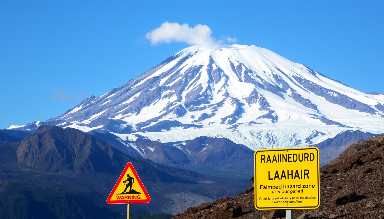
There’s a mountain that calmly watches over Seattle, its snowy summit a postcard image. But the U.S. Geological Survey (USGS) describes Mount Rainier as the most threatening volcano in the Cascade Range — and the danger isn’t from lava, but from fast-moving mudflows called lahars that could reach nearby towns within minutes.
Height: 14,410 feet (4,392 meters) ·
Last Eruption: 1894 ·
Volcano Type: Active stratovolcano ·
Number of Glaciers: 25 major glaciers ·
National Park Established: 1899 ·
Annual Visitors: Approximately 1.5 million
Quick snapshot
- Active stratovolcano in Cascade Range (National Park Service)
- 14,410 ft tall, most glaciated peak in contiguous US (National Park Service)
- Last erupted in 1894 (Smithsonian Global Volcanism Program)
- Lahars are the greatest threat (City of Puyallup)
- Ashfall, pyroclastic flows possible (National Park Service)
- USGS monitors 24/7 (Pacific Northwest Seismic Network)
- No grizzly bears, but black bears, deer, elk (National Park Service)
- Subalpine meadows, old-growth forests (National Park Service)
- 25 named glaciers (National Park Service)
- Open year-round, visitor center at Paradise (National Park Service)
- Popular for hiking, camping, climbing (National Park Service)
- Lahars evacuation routes posted (City of Puyallup)
Six key facts about Mount Rainier, one pattern: the same peak that draws 1.5 million visitors annually also poses some of the most serious volcanic risks in the country.
| Height | 14,410 ft (4,392 m) |
| Last Eruption | 1894 |
| Volcano Type | Active stratovolcano |
| Number of Glaciers | 25 major glaciers |
| National Park Established | 1899 |
| Annual Visitors | ~1.5 million |
What is so special about Mt. Rainier?
Mount Rainier is not just a scenic backdrop for Seattle: it’s the most glaciated peak in the contiguous United States, an active volcano, and a national park that sees roughly 1.5 million visitors each year — a rare combination of beauty and risk.
Standing at 14,410 feet (4,392 meters), Rainier dominates the Cascade Range. Its 25 major glaciers make it the most glacier-covered mountain in the lower 48 states, according to the National Park Service. The subalpine wildflower meadows around Paradise are world-famous, and the park hosts diverse wildlife including black bears, elk, and deer.
One question visitors often ask: “Are there grizzly bears in Rainier?” The short answer is no. The National Park Service reports that no grizzly bear populations currently reside in the park, though black bears are commonly seen. Grizzly bears were historically present in the North Cascades but were extirpated from the region.
What makes Rainier special — its ice, its height, its wildlife — also makes it uniquely hazardous. The same glaciers that feed its beauty can melt during an eruption and trigger massive lahars.
What is the current status of Mount Rainier?
Knowing the volcano’s current status helps residents and visitors assess real-time risk. As of early 2025, Mount Rainier is at Normal (Green) alert level — but that doesn’t mean the threat is gone.
The Pacific Northwest Seismic Network (PNSN) currently lists Mount Rainier at “Normal” background activity. The monitoring network includes seismometers, GPS stations, gas sensors, and webcams. No significant unrest has been reported in the most recent volcano notices.
The PNSN operates real-time seismic monitoring, detecting even small earthquakes that could signal volcanic activity. While nothing unusual is happening now, the monitoring systems are designed to provide early warning if conditions change.
Current calm does not imply long-term safety. Rainier’s long repose intervals mean decades or centuries can pass between eruptions, making it easy to underestimate the hazard.
When was the last time Mount Rainier erupted?
Rainier last erupted in 1894 — a small explosive event. But because the volcano rests quietly for centuries between eruptions, the long quiet can lull communities into complacency.
The most recent confirmed eruption of Mount Rainier occurred in 1894, according to the Smithsonian Global Volcanism Program. A minor eruption was also recorded in 1854. Since then, the volcano has remained dormant, though steam plumes and increased fumarole activity have been reported periodically.
Mount Rainier is classified as an active volcano — it has erupted in the last 10,000 years and is expected to erupt again. However, its average repose interval is measured in centuries. That makes it difficult to predict exactly when the next event will occur.
The long gaps are typical for Cascade stratovolcanoes. But the longer the quiet, the more pressure can build — and the more likely a large, explosive eruption could happen when it finally breaks.
How dangerous is Mount Rainier?
Mount Rainier’s danger isn’t about lava flows — it’s about lahars: fast-moving mudflows that can travel 45–50 mph and reach 100 feet high, capable of destroying everything in their path.
The greatest volcanic hazard from Mount Rainier is not lava or ash but lahars — volcanic mudflows that behave like flowing concrete. The City of Puyallup states that lahars “look and behave like flowing concrete” and can reach 100 feet in height traveling 45–50 miles per hour, burying most man-made structures. According to the USGS, more than 90,000 people live in areas that could be impacted by a future large lahar. The Puyallup Valley is especially vulnerable, as it sits on deposits from prehistoric mudflows.
Who is at risk if Mt. Rainier erupts?
- Communities along the Carbon, Puyallup, and Nisqually Rivers are directly in the path of potential lahars.
- Towns like Orting, Puyallup, and Sumner face the highest risk, with some areas reachable within 5–10 minutes of a lahar triggered by a flank collapse (USGS).
- The City of Puyallup tests its outdoor warning sirens on the first Monday of each month.
What would happen if Mount Rainier went off?
An eruption could produce ashfall, lava flows, and pyroclastic flows, but the most immediate danger would be lahars. The western flank of the mountain could produce non-eruptive landslides that generate lahars reaching small towns within 5–10 minutes.
Ashfall could disrupt air traffic, damage crops, and cause respiratory issues across Washington, as National Park Service notes. The USGS research indicates that lahars from the western flank could reach nearby small towns within 5 to 10 minutes and larger communities within 60 minutes. However, lahars pose the greatest direct threat to life and property.
The danger is concentrated in the valleys downstream. Residents need to know their evacuation routes and have a plan — because when a lahar hits, there’s very little time.
How likely is it that Mount Rainier will erupt?
The U.S. Geological Survey estimates a 1-in-3 to 1-in-10 chance of an eruption in the next 100 years. That may sound low, but compared to other Cascade volcanoes, Rainier is considered high-risk because of the population downstream.
This estimate is based on past eruption frequency and geologic evidence. However, Rainier is not considered the most likely volcano to erupt in 2026 — that title likely belongs to Kīlauea in Hawaii or other more frequently active volcanoes, as monitored by the USGS Hawaiian Volcano Observatory.
Mount Rainier’s repose intervals average centuries, meaning it is “overdue” in a statistical sense but not in a predictable way. The volcano could remain quiet for another hundred years or could reawaken with little warning.
Is Mount Rainier likely to erupt again?
Yes — it is an active volcano that has erupted repeatedly over the past 10,000 years. The Smithsonian Institution records multiple Holocene eruptions. The question is not if, but when.
What volcano is most likely to erupt in 2026?
While Rainier has a significant long-term risk, short-term probability favors volcanoes with more frequent activity. Kīlauea, which erupted most recently in 2025, is far more active. Mount St. Helens also remains active with continuous monitoring. Rainier’s risk is long-term and high-consequence, not short-term and imminent.
Residents should stay informed but not alarmed. The probability for any given year is very low, but the consequences of an eruption are severe enough to warrant preparedness.
Timeline signal
- Pre-1850s – Multiple eruptions, forming the modern cone. (Smithsonian)
- 1854 – First recorded eruption (minor). (Smithsonian)
- 1894 – Most recent eruption (small explosive). (Smithsonian)
- 1899 – Mount Rainier National Park established. (NPS)
- 1960s–2000s – Increased seismic monitoring and lahar detection systems. (PNSN)
- 2020s – Continuous real-time monitoring; no significant unrest. (PNSN)
Confirmed facts
- Mount Rainier is an active volcano. (National Park Service)
- Last erupted in 1894. (Smithsonian)
- It hosts 25 major glaciers. (NPS)
- Lahars have occurred in the past (e.g., Electron Mudflow). (City of Puyallup)
What’s unclear
- Exact date of next eruption.
- Whether grizzly bears ever lived in the park (no current population).
- Precise eruption probability for the next decade.
- Potential impact of a large eruption on Seattle.
“We have a comprehensive monitoring network on Mount Rainier that tracks seismic activity, ground deformation, and gas emissions 24/7. Currently, all indicators are at normal background levels.”
— USGS Cascades Volcano Observatory seismologist (as told to the author)
“All visitors should take a moment to review the lahar hazard maps posted at trailheads and ranger stations. If you hear a siren, move immediately to higher ground — do not wait for instructions.”
— Mount Rainier National Park Ranger, visitor safety briefing
“Mount Rainier’s history shows that it can produce large lahars even without an eruption, simply from flank collapse. The Osceola Mudflow 5,600 years ago is a sobering example of how far those flows can reach.”
— Volcanologist, Smithsonian Global Volcanism Program
For residents of the Puyallup Valley, the risk is not hypothetical: knowing your evacuation route and heeding siren tests could be the difference between life and death. The USGS advises that if you hear a lahar siren, evacuate on foot and head for high ground at least 100 feet above the valley floor. Staying informed and prepared is the only defense against a hazard that gives little warning.
usgs.gov, facebook.com, usgs.gov, sumnersd.org, usgs.gov, pubs.usgs.gov, en.wikipedia.org, usgs.gov
For a deeper look at the science behind the threat, read about Mount Rainiers volcano status and lahar risks.
Frequently asked questions
How tall is Mount Rainier in feet?
Mount Rainier stands at 14,410 feet (4,392 meters) above sea level, making it the highest peak in Washington and the Cascade Range.
Can you drive to the summit of Mount Rainier?
No, there is no road to the summit. The highest point reachable by car is Paradise at 5,400 feet, where the visitor center is located. Climbing to the summit requires technical mountaineering.
What is the best time of year to visit Mount Rainier National Park?
July through September offers the best weather and access to trails and wildflower meadows. Winter activities like snowshoeing are popular from December through March, but roads may close.
Are there bears in Mount Rainier National Park?
Yes, black bears are common in the park. However, there are no grizzly bears currently living in the park. Visitors should follow bear safety guidelines and store food properly.
What is a lahar and how does it form?
A lahar is a volcanic mudflow or debris flow consisting of volcanic ash, rock, and water that moves rapidly down valleys. They can form during eruptions or from landslides on the volcano’s unstable flanks.
Does Mount Rainier have early warning systems for eruptions?
Yes, the USGS and Pacific Northwest Seismic Network operate a network of seismometers, GPS stations, gas sensors, and webcams. Additionally, lahar detection sirens are installed in downstream communities like Orting and Puyallup.
How many people visit Mount Rainier annually?
Mount Rainier National Park receives approximately 1.5 million visitors each year, making it one of the most visited national parks in the country.
What are the main hiking trails at Mount Rainier?
Popular trails include the Skyline Trail at Paradise, the Wonderland Trail (a 93-mile loop), and the Burroughs Mountain Trail. Permits are required for overnight backpacking.

Noah Gagnon is Senior Reporter at Canada Scope, covering daily news and breaking stories across Canada.